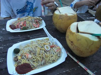
1st January (Thursday)
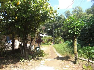
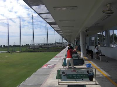
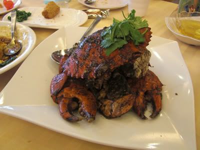
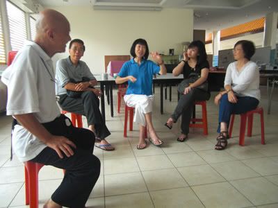
It is New Year's day and WG suggested that we pay a visit to a temple we have not visited for many years. It is Bao En Si (报恩寺) along Chwee Chien road, just off Pasir Panjang road. This is a very peaceful temple and the temple's caretaker - Mr Lee, is very friendly.
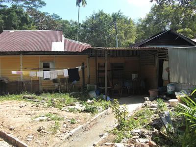
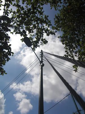
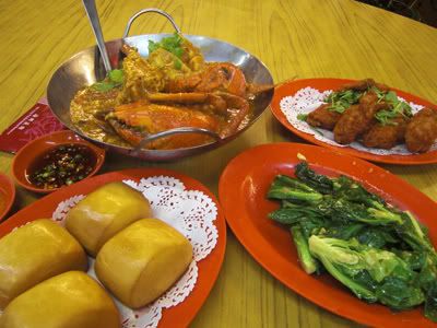
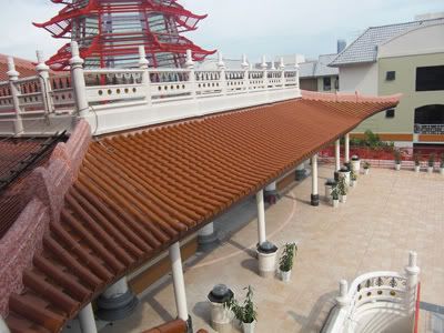
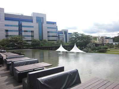
The temple is currently under renovation and will be completed by end of the year. A number of its rooms are completed and it is already open up for visitors to visit and participate in its activities. This is the new main hall with a pagoda at the top.
今天是新的一年,WG建議我們去探訪一間寺廟,已經有好幾年沒去了。這是報恩寺。是一間很平靜的寺廟,主管非常友善,是一位名叫李先生。還記得那時是2003年,我與我的委員會在這間寺廟住了兩晚。當時好好玩,住在那兒有些冒險的感覺。
現在寺廟正在修建,年底就會完成。可是已經有好幾棟樓已經建好了,而且公衆也可以開始參與活動。這是大雄寶殿與現代佛塔。
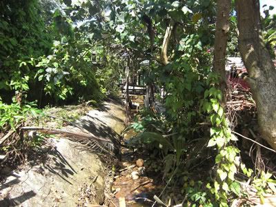
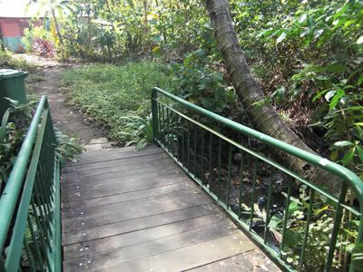
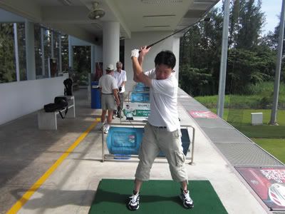
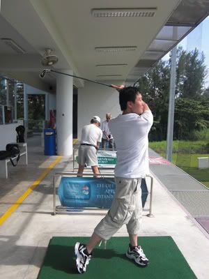
Though the main shrine area is slightly enclosed, but we still managed to find our way in. The back of the temple overlook Bukit Chandu (Kent Ridge Park). While we were there snapping away our photos, Mr Lee came in with a few visitors. He asked us whether would we like to join in for his introduction on the history of this area. We happily agreed to it.
He began by telling about the story of Bukit Chandu. We have heard the WWII story before. But we were taken aback by another story, the story of Bukit Chandu under the British rule. Bukit Chandu is a malay word for Opium Hill. Throughout his story, it really raise a few important questions that we missed out previously. Why were young Malay soldiers recruited to fight the war for the British after only 2 weeks of training? Why did the Japanese invaded down Southeast Asia after a 30 years break from their last battle? The history books did not answer these questions and Mr Lee explained to us the reasons behind it. I shared with a few of my close friends what Mr Lee shared with us. It is really quite revelationary.
即使大廳稍微被封住,可是我們還是可以走過去。大雄寶殿後方就面向鴉片山。正當我在拍照時,李先生就帶領一群光光者來到了這兒。他問我們是否有興趣參與他對這一帶的曆史介紹。我們很樂意地答應了。
他開始講述鴉片山的故事。我之前就有聽過世界大戰二在這兒所發生的悲劇。可是我們似乎被另外一個故事所吃驚,就是鴉片山在英國殖民地的時代。李先生在講述故事當中,就讓我反省了幾個沒有考利過的問題。爲何年輕的馬來士兵被派去前線,受過兩個星期的訓練,就爲英國政府戰鬥而死?爲何日本等了30年的時間才打算打下東南亞?曆史書籍沒有講述這一些原因。我跟幾個好朋友分享了故事。真是一鳴驚人。
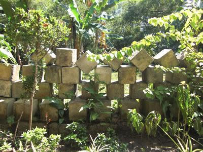
Mr Lee brought us to a section of the temple still under renovation. There is this small area enclosed by fence and he mentioned that while the temple is undergoing upgrading, the workers came upon this rock-solid structure. He inquired with the National Heritage Board and found out it is actually a Gun Turret base. The National Heritage Board let Mr Lee decide whether he wish to remove it, buried it or keep it. Mr Lee opted to preserve it and to share it with the future generations. This temple is very environmentally and elder friendly. Visitors to this temple should check out how they go about doing it.
李先生帶我們走到正在維修的露天走廊。在這兒有個被籬笆所圍繞的一個空間。他說當這一間寺廟在繁新時,工人發現了一個很堅硬的石磚。他訪問了國家文物局,了解這其實是世界大戰二所余留下來的大炮廳。國家文物局讓李先生決定是否保留,遷移或毀掉它。李先生選擇了保留,以下一代分享。
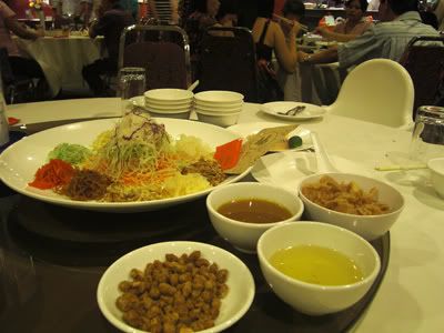
It started raining heavily shortly after and we have to take refuge in the temple. We proceeded to the dining hall and started chatting. It is really a fascinating discussion we have for the next 1 hour or so. Two of the visitors are on a short visit from Australia. We discussed on many things, ranging from topics on the economy, Buddhism, the coffin experience in Thailand, history of Singapore and so on. It's been a while since we last had such a meaningful and fruitful sharing. (The last time was last year during Pa Auk's retreat). It is perfect when we have people coming from different age groups and coming together discussing on matters of life.
天色突然轉變,不久就下了大雨。我們只好在這間寺廟稍微避雨。我們去了食堂,就開始聊了。不知不覺就聊了一個多小時。有兩位光光者是來自澳大利亞。我們討論了許多話題,有關國際經濟,佛教,泰國棺木經驗,新加坡曆史等。已經有好一段時間沒有好好參與這樣的分享了(最後一次是在緬甸帕奧禅師的禅七裏)。最好的分享是當每個人員來之不同的背景,一起來商量生活的意義。
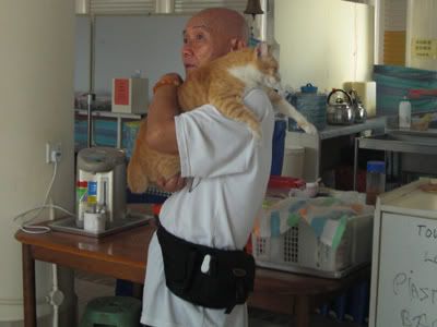
There are many cats in the temple. Here is Mr Lee carrying this cat. The cat is very close to Mr Lee and will follow him around wherever we went.
在這一間寺廟有許多小貓咪。以下的照片是李先生包住小貓。這只小貓咪跟李先生很密切,走到哪兒就跟到哪兒。
We bid a farewell to the temple. But we know we will be coming back in the future again. Thank you Mr Lee for your sharing.
我們告辭了寺廟。可是我們也知道不久的未來,我們會再回來的。謝謝李先生這一次的分享。
4th January (Sunday)
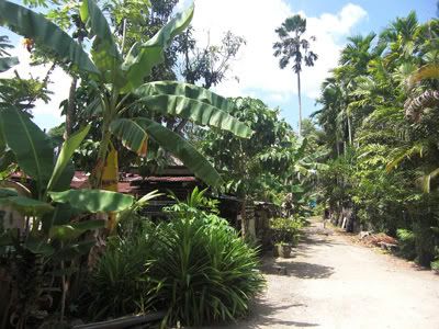
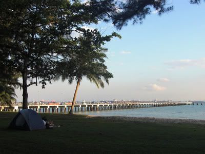
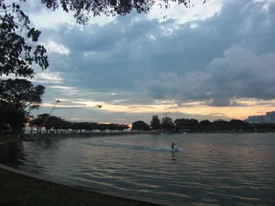
Singapore's Southern Ridge is officially opened last year. I have been looking forward to visit it since I read it on the newspapers while overseas. This time round I finally have the chance. Sunday is normally a family day for me. But my family will be away during this day, so I have the chance to arrange with FP on the adventure to the Southern Ridge. I rendezvous at his house at 12pm. After lunch, we took a bus down to Pasir Panjang road. We begin our adventure at 2.30pm from Pepys Road. The entire Southern Ridge journey consists of many hills to climb, so we have to be physically ready for it.
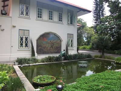
From Pepys, we begin our way up to the top of the hill. Winding through the hills, we finally arrived at the Reflections at Bukit Chandu. This is a house dedicated to the Malay soldiers that fought and died during World War II.
新加坡南部山脊步道在去年正式開幕。我已經期待南部山脊步道的這一個探險。機會終于來了。星期日通常是我與家人用餐的一天。可是這一天,大家都不在家。所以有機會與FP去探索南部山脊步道。我12點在FP的家會合。用了午飯,就程達巴士前往巴西班讓路。從2.30pm就開始行走。整個南部山脊步道有許多小丘,所以要做好准備。
從們走到了第一個丘上,這就是鴉片山的博物館。這個博物館是紀念在世界大戰二備戰而死的馬來軍人。
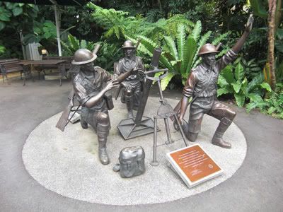
Here is a model of the soldiers manning a mortar.
這兒有軍人預備大炮的模型。
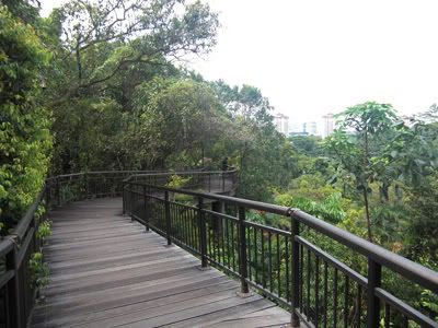
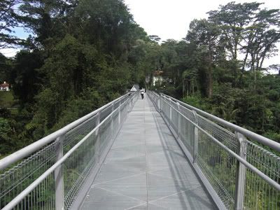
From the side of the Reflections at Bukit Chandu, it connects directly to the Canopy Walkway. This is actually a raised wooded pathway along Kent Ridge park, allowing visitors to have a panoromic view of the area.
在鴉片山的一旁就連接著樹上天橋。這是一個高樓木橋,沿著肯特崗公園,光光者可以展望著這一帶的風景。
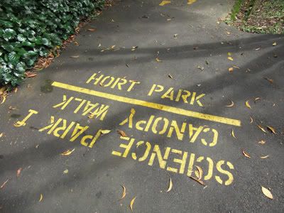
There are clear direction signs along the way so visitors will not get lost throughout the entire journey. This is our starting compass. From Canopy Walk, we will be proceeding to Hort Park.
在這兒有許多方向排,所以遊客肯定不會走錯方向。這一是我們的行走指南。從樹上天橋,我們來到了園藝園林。
The route to the Hort Park meanders through the hills down. If you have a good pair of shoes, you can just bash down the hills. I come equipped with my simple slippers, but it is of no problem bashing down too.
去園藝園林的路需要走下山。如果你有一雙良好的鞋子,那應該沒有問題跑下山。我是穿著拖鞋,也沒問題。
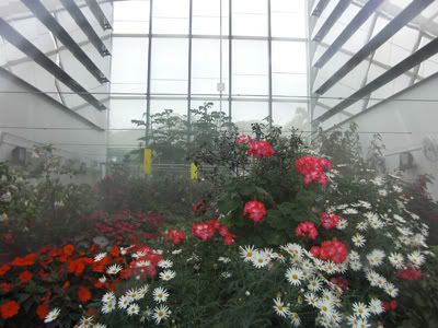
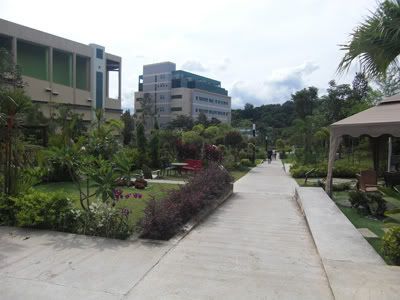
The HortPark has several glasshouses containing plants from all over the world. We have this temperate glasshouse kept in well regulated temperature and humidity, allowing flowers to bloom all year round.
園藝園林有許多玻璃家,裏頭有來之各國的花朵。以下的照片是來自溫帶氣候的花兒。玻璃家的氣溫都保持到很完美,四季如春,花朵每一次都盛開。
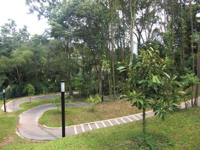
Beyond the glasshouses, we walked through the Hort Park.
過後就來到了園藝園林。
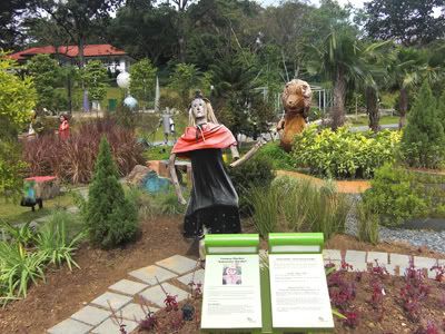
The kids will love it here. It has many playgrounds and below we have figurines from the Wizard of Oz.
有很多小孩喜歡在這兒玩耍。
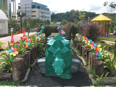
A little Dino park.
一個小恐龍園。
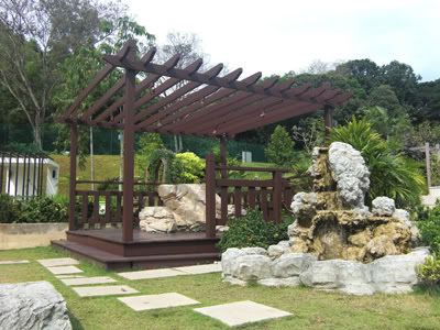
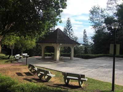
Pavilions with different themes also lined the entire stretch of Hort Park. Visitors can just sit back and enjoy the peace in this area.
亭子于不同的風格設計在園藝園林展現了出來。遊客可以坐在亭子享受甯靜的環境。
At the end of Hort Park, there are also opportunities for fine dining just next to a quiet pool of water. We took a short isotonic break here.
在園藝園林的終點,遊客可以在平靜的水池用餐。我們也在這兒歇了一會兒。
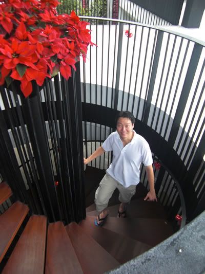
I went to check out this circular flight of stairs leading down and came back up again.
有一個環形樓梯。
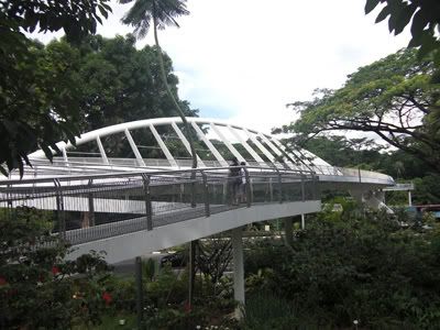
From Hort Park, we were led directly to the next area, the Alexandra Arch. This bridge is tall and spans across a fast traffic road.
下一站是亞曆山大拱橋。
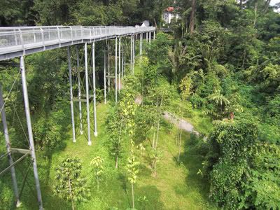
From the Alexandra Arch, we begin our next segment of journey at the Forest Walk, which stretches the entire area of Telok Blangah Hill Park. Some of the walkways are perched very high off the ground. If you were to look from the side or just look through the holes, you will realise it is really high up.
從亞曆山大拱橋就連接到叢林小徑,跨越整個落布蘭雅山。有些路道是很高的。
It is a straight road ahead.
路直走.
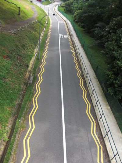
While walking down the lane, we noticed this no-traffic straight road with zig-zag lines by the side. To those who are new to Singapore's traffic rules, zig-zag lines mean no stopping.
從高處,見到了這一個彎曲線的路。彎曲線代表不准停車。
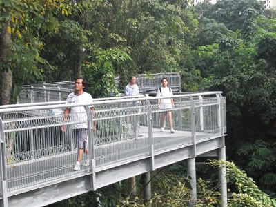
There are many park visitors trying out the Forest Walk too.
這一天也有許多遊客在叢林小徑上。
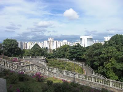
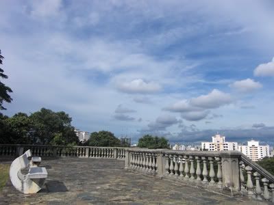
The highest point of Telok Blangah Hill Park is the Terrace Garden. This place is really a great spot for photo-taking. I'm actually quite surprised such a place exist.
這兒是落布蘭雅山的最高點。是一個很優美的地點。
After reaching the hilltop, we took a short break at one of bench. Savouring the moment.
到了山頂,我們歇了一會兒。
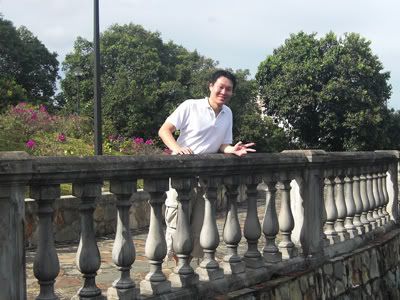
Here I am posing at one of the edge.
我個人照。
Towards the end of Telok Blangah park, we noticed more pavilions along the way.
走完了落布蘭雅山,又見到許多亭子。
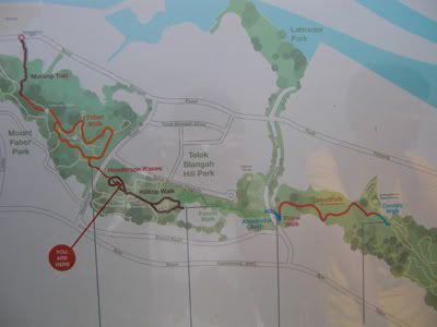
Here is the entire map starting from Reflections at Bukit Chandu at the right hand side to our final destination at Vivo City at the left hand side. We are more than 50% past and is approaching Henderson Waves.
這是整個路程的地圖。我們從右手開始步行,終點在左手旁的怡豐城。我們已經走超過一半的路。
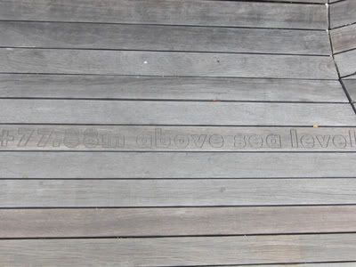
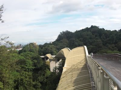
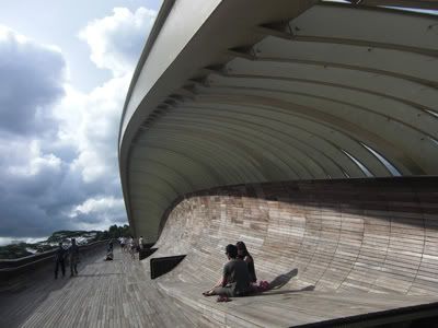
Henderson Waves is actually a very high-levelled pedestrian bridge. There is a mark on the bridge wood indicating it is 77.88m above sea level (20 storeys high). It spans across Henderson Road.
下一站是波浪橋。這個橋是整個路程中最高的一棟橋。下面的照片顯示海拔77.88公尺(二十樓高)。
Henderson Waves is named for its wavy design.
波浪橋的設計像海浪一樣。
Here is Henderson road, check out its height. It's even taller than the surrounding residential flats.
波浪橋的最高點。
It is also a great place for visitors to rest and chill out. You are closer to the sky over here than the anywhere else in the vicinity.
這是一個良好的地方休閑。
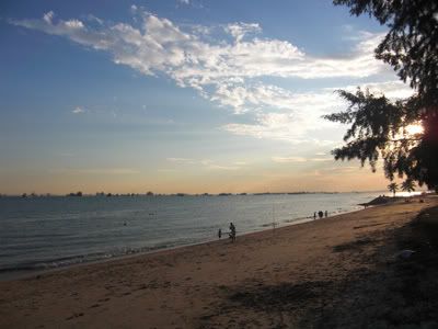
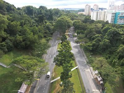
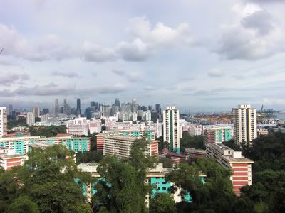
We arrived at Mount Faber Park. It is another uphill climb to the top. Along the way, we caught sight of the Singapore's city skyline and residential areas.
我們來到了花柏山公園。從這兒又要往上爬。在路中,見到了新加坡商業區與住宅區的風景。
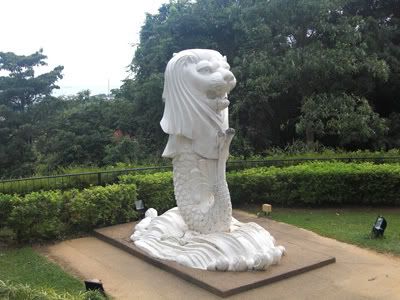
At the top of Mt Faber park is our Singapore icon, the Merlion. This one is not spraying water.
這是新加坡的魚尾獅。這個沒有在噴水。
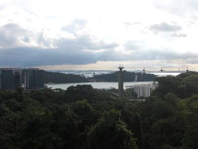
We can also catch sight of the cable car and Sentosa island in the backdrop.
從這兒見到了纜車與聖淘沙島。
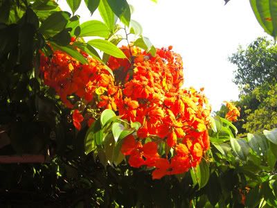
While walking down Mt Faber hill, we saw some beautiful flowers along the walkway.
走下花柏山時,見到美麗的花兒。
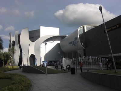
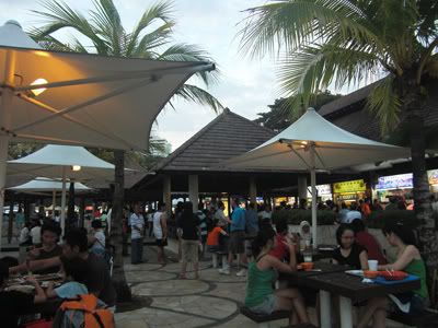
The final part of the journey is along Marang Trail which just leads downhill through a forested path towards Marang Road. Once there, we can see Vivo City. It is 5.30pm when we completed the entire journey. So the Southern Ridge walk at a normal pace is 3 hours in all. It feels good to be back in air-conditioned shopping area after a vigorous outdoor trek.
路過最後一個連接段,Marang Trial,我們終于見到了怡豐城。時間已經是5.30pm了。一共花了3小時。從大自然又回到了大城市。